


i-Boating:Persian/Arabian Gulf app for iPhone and iPad
Developer: Bist LLC
First release : 28 Apr 2016
App size: 56.66 Mb
GPS Marine Charts App offers access to charts covering Arabian/Persian Gulf & Red Sea (incl. Oman, United Arab Emirates, Iran and Qatar). Only marine GPS app to have route assistance with Voice Prompts for marine navigation. It has route manager to create new boating routes or import existing GPX/KML routes. It supports Nautical Charts course up orientation.
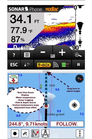
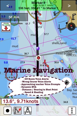
► Voice Prompts for marine navigation (requires GPS )
-prompts when approaching a boating route marker
-Continous distance and ETA updates
-Alerts when sailing/boating off route
-Alerts when boating in wrong direction
►Route Editing/Creation
-Create routes from scratch
-Edit existing GPX/KML routes.
-Add custom description to any route point.
-Drop markers along route.
► Advanced NMEA Instrumentation
√AIS over TCP/UDP
√Wind speed, direction, temperature, depth, GPS over NMEA
► Offline charts for Persian/Arabian Gulf, Red Sea and Gulf of Aden.
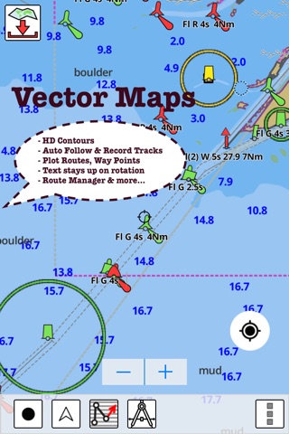
►Seamless chart quilting of marine charts
► Persian/Arabian Gulf
-Iran & Qatar: Chiru, Khafji & more.
►Distance Bearing tool
►Oman
-Mirbat, Muscat, Sohar, Hormuz & more.
►Create custom way points
- Using GPS
-Select point on map
-Manually enter latitude & longitude coordinates
► Red Sea and Gulf of Aden
-Melita Bay, Strait of Tiran, Yemen, Zeit & more
► United Arab Emirates
- Al Jeer Port, Khalifa Port & more
*Pan/Zoom/My Location
* Record Marine GPS tracks
* View tracks overlay
* Live track animation
* Track analytics/stats
► Export GPX tracks.
-Export to SDCard
-Share GPX trakcs with friends/View on Google earth.
►Auto Follow Mode (Course up)
-Continuously updates boats location on chart
- Adjustable update frequency
Battery Disclaimer:
"Continued use of GPS running in the background can dramatically decrease battery life."